
Arbetet med VOACAP on-line löper vidare, med allt fler förbättringar. Det är Jari OH6BG som nu har lagt till beräkningar av skymningszonen – eller grayline som vi brukar säga. Grayline-beräkningarna är ett bra komplement till Voacap, främst på de lägre frekvenserna. Nedan är ett exempel på beräkningarna mellan Sverige och Boyvet ön i januari 2018. Vår natt verkar vara ett bra tillfälle att försöka knipa expeditionen på de lägre banden.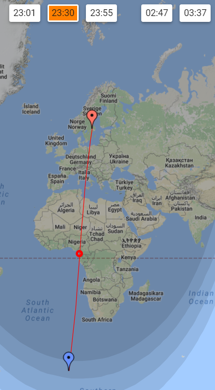
Så här skriver Jari i ett mail:
“I have been upgrading the VOACAP Point-to-Point service with grayline-related calculations as we all know that VOACAP is not doing so great with long-distance low-band propagation predictions. So, to help the low-band enthusiasts, I created the “All-year Grayline” service which calculates the most important grayline-related times (in UTC) for the chosen path – for every day of the year. The results will be displayed on a separate page with some evaluation for times which could provide enhanced signal levels. There are three color codes to mark the “enhanced” time periods: green, blue and red.
Also, to visualize better what’s going on with the day and night, each day of the year (in the DATE column) is a hyper-link, and when clicked, another tab will open a Google Map, displaying the TX and RX, a red great-circle line (via short-path) and a small red circle which shows the geographical midpoint between TX and RX. The top of the page shows a number of clickable time boxes (the times which were calculated on the previous page), and when you do click them, the terminator line will be set accordingly on the map. The time boxes provide a tooltip when you hover the mouse over them, explaining the time in question. ”
Kolla själv på Voacap-sajten!